Ok all you map nerds, here’s how to interpret these early survey maps.
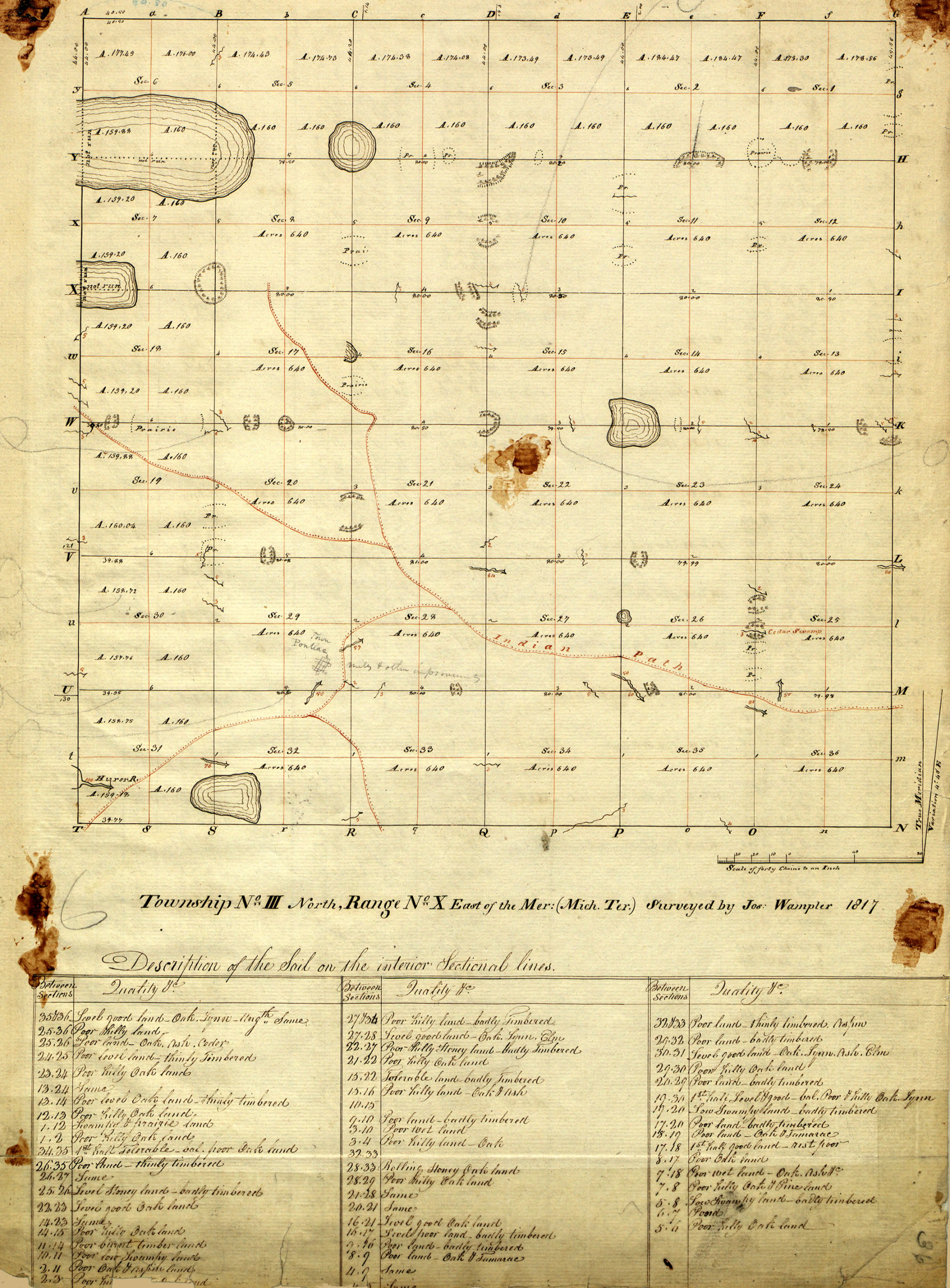 |
This is Pontiac Township, or in survey-speak, Township 3 North, Range 11 East. You can see it’s a grid pattern. The township itself is 6 square miles, so each box in the grid is one square mile, and are called sections.
Surveyors walked the lines making up the grid, creating it as they went. They started at the lower right corner and walked west for six miles, then north for six miles, then east, then south and back to the beginning. As they walked, at every half mile they set a post in the ground and marked it. They took observations on ground conditions, trees and foliage, and waters. They noted these in a notebook. On this map, you can see they have given a summary at each post location. |
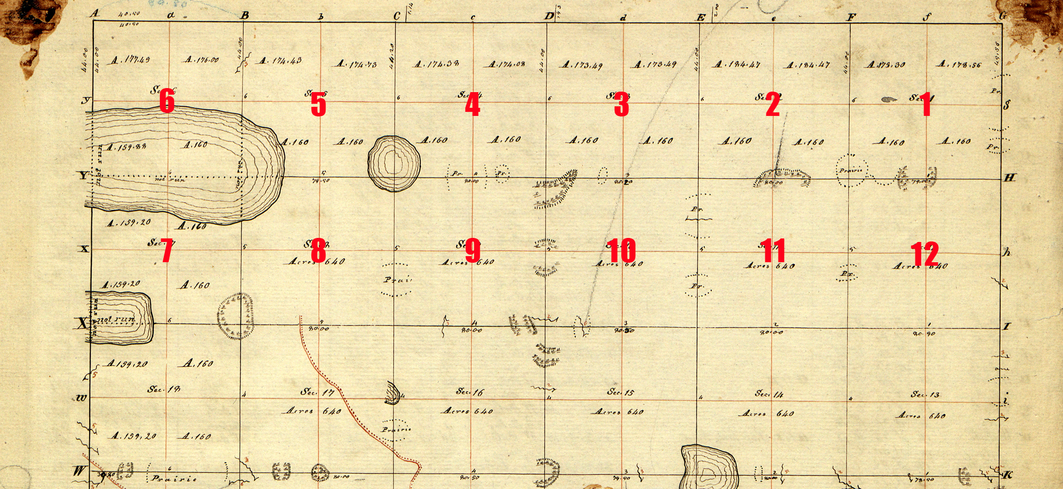 |
When they walked the interior lines, they did so in a zig zag, starting at the top right and working west, then back east in the second row, then back west in the third, and so forth. As they went, they numbered the sections.
And they kept notes. |
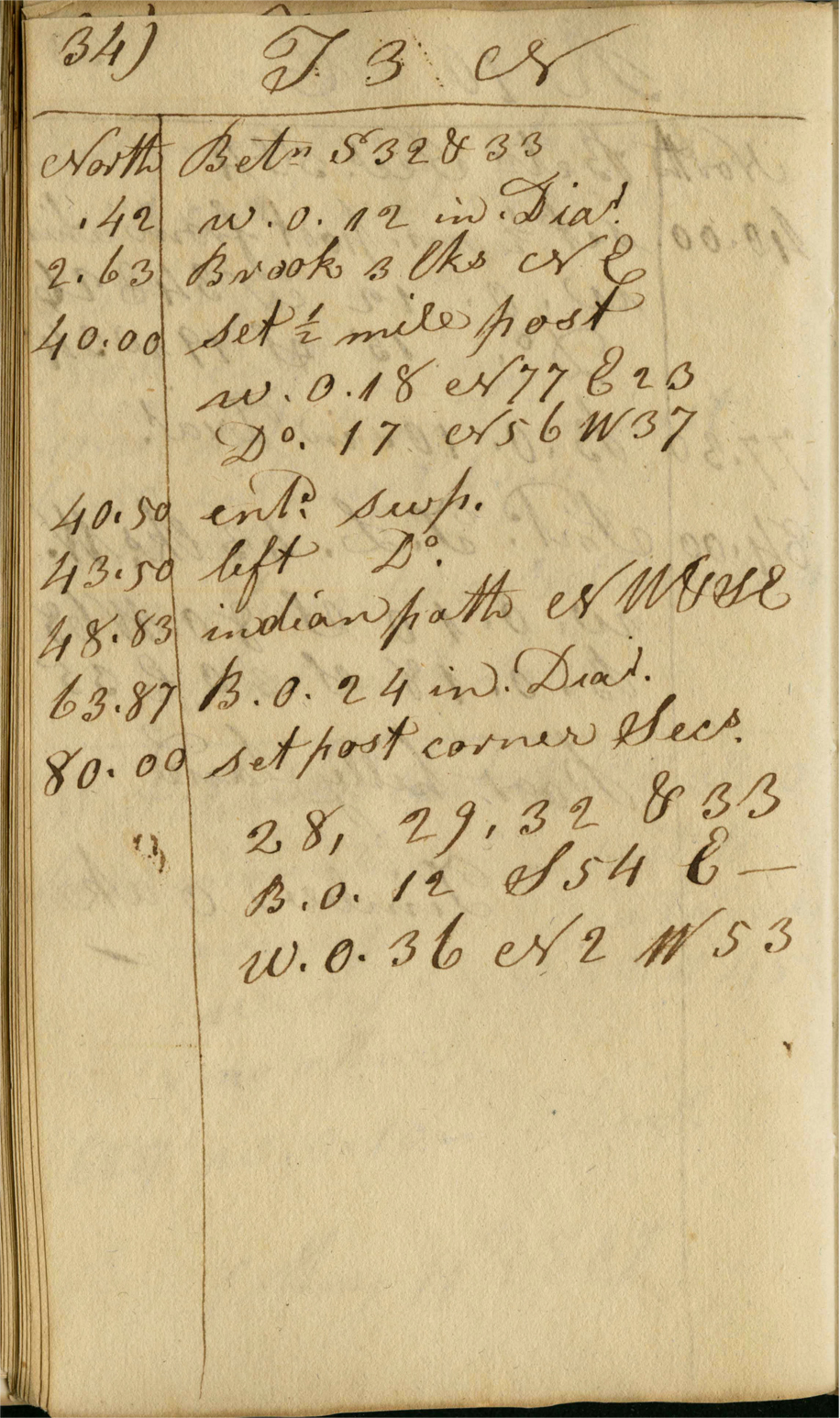 |
Loosely Translated North Between Sections 32 and 33 00.42 White Oak 12 inch in dia. Knowing what trees and other foliage were present was important information to a prospective settler because it told them about soil conditions. |
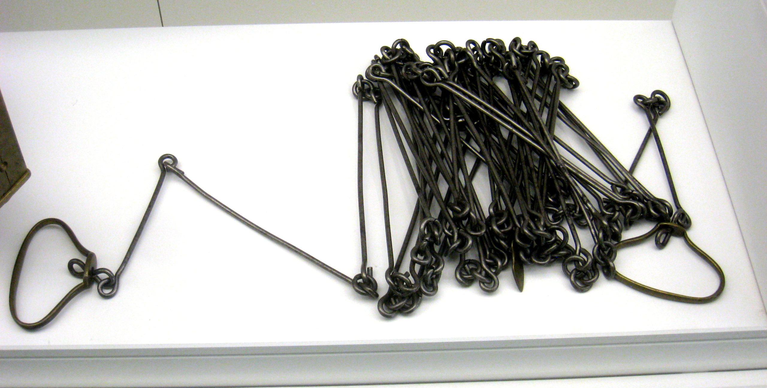 Exhibit in National Museum of American History, Washington, DC, US. Exhibit in National Museum of American History, Washington, DC, US. |
Measurements were taken using a Gunter’s chain. A chain is 100 links long and a link is 7.92 inches long. In the survey notes, the number to the left of the decimal is the number of chains, and the number to the right is the number of links. The useful conversions are that one chain equals 66 feet, and ten chains square equals one acre of land. |
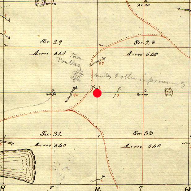 |
The notes state they set a post here, at the intersection of 4 sections – 28, 29, 32 and 33. You can see in the image that they’ve noted native american trails, swamps, rivers, and lakes, and those all appear in the notes. The native american trails were added later, but were the primary way to get into the territory at the time. |
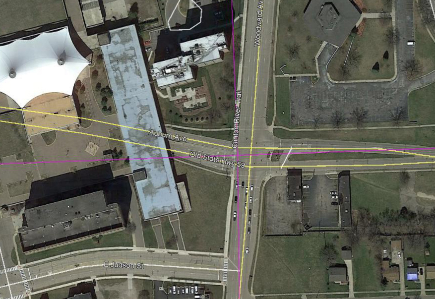 |
This is that post location today – the intersection of the Woodward Loop and Orchard Lake/Auburn Road in Pontiac. The tent-like roof of the Phoenix center is to the left. |
 Pioneer Highlands
 A2 - Indian Village and Ottawa Hills
 A3 - Seminole Hills
 B1 - Oakwood Manor
 B2 - North Perry Street
 B3 - Indian Village and Franklin Blvd
 B4 - S of Pike bet. Parkhurst and MLK
 B5 - Sylvan Village
 B6 - Orchard Lk N of Golf
 B7 - Square Lk south of Telegraph
 B8 - Bloomfield Highlands
 C1 Walton Boulevard
 C2 - Kennett & Oakland
 C3 - Pontiac Lake Rd
 C4 - Joslyn and Columbia
 C5 - Perry and Montcalm
 C6 - South of Rundell
 C7 -Perry and Grandview
 C8 Howard and Perry
 C9 - Cesar Chavez - Pinegrove
 C10 - Lawrence and Williams
 C11 - Union and University
 C12 - Perry S of Pike
 C13 - Voorheis - Orchard Lake